Powered by Obi Mbieri Independent Media Ltd · eziokwubundu.com
$1 = ₦1,328€1 = ₦1,496£1 = ₦1,754List of Autonomous Communities in Mbaitoli LGA
Mbaitoli Local Government Area is one of Imo State's most historically layered and administratively significant territories. Home to a network of ancient clans, vibrant markets, and a growing population of entrepreneurs, farmers, and professionals, Mbaitoli occupies a central place in the social and...
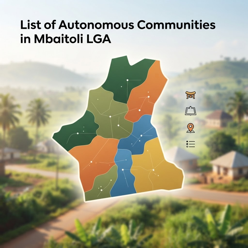
Mbaitoli Local Government Area is one of Imo State's most historically layered and administratively significant territories. Home to a network of ancient clans, vibrant markets, and a growing population of entrepreneurs, farmers, and professionals, Mbaitoli occupies a central place in the social and economic life of Imo State. Yet despite its prominence, many Nigerians — including those with roots in the area — remain unclear about how its communities are formally organized, how many autonomous communities currently exist, and what the distinction is between the nine founding clans and the larger number of state-gazetted units recognized today.
This article provides a comprehensive, accurate breakdown of the list of autonomous communities in Mbaitoli LGA — from its nine foundational towns to the subdivided units created through successive state government actions. Whether you are a community stakeholder, a diaspora Nigerian tracing your roots, an entrepreneur conducting due diligence for local investment, or a student researching Imo State's administrative geography, this guide is written to inform and empower you.
What Is Mbaitoli's Historical and Administrative Structure?
Origins, Geography, and the 1989 Creation
Mbaitoli Local Government Area was formally established on May 11, 1989, when the administration of General Ibrahim Babangida carved it out of the former Mbaitoli/Ikeduru Local Government Area. This restructuring was part of a broader national exercise that created new LGAs across Nigeria to decentralize governance and bring administration closer to the grassroots. The separation of Mbaitoli from Ikeduru gave each territory its own distinct administrative identity, budget allocation, and governance structure.
The LGA's administrative headquarters is located at Nwaorieubi (also spelled Nworieubi), a town positioned along the Owerri–Orlu federal road — one of the most commercially active transport corridors in southeastern Nigeria. This placement along a major federal artery has made Nwaorieubi a natural hub for commerce, trade, and institutional activity within the LGA.
Geographically, Mbaitoli covers approximately 204 square kilometres, a land mass that accommodates a diverse range of agricultural land, market centres, and urban-fringe communities. Its borders are strategically significant: the LGA is flanked to the south by Owerri Municipal and Owerri North/West, to the east by Ikeduru LGA, to the north by Njaba and Oru LGAs, and to the west by Oguta LGA. This positioning at the intersection of several major LGAs makes Mbaitoli a transit hub connecting Owerri's urban sprawl to the more rural regions of northern Imo State.
For a broader contextual understanding of the area's administrative and social history, the Complete Guide to Mbaitoli Local Government Area Imo State provides an in-depth foundation.
The LGA's combination of fertile agricultural land, proximity to Owerri's markets, and access to federal roads positions it as one of the more economically dynamic LGAs in Imo State — a fact that makes accurate knowledge of its community structures especially important for investment, land registration, and development planning.
Which Are Mbaitoli's Nine Foundational Clans?
The Ancient Towns Behind the "Mba-Itoli" Name
The very name "Mbaitoli" is rooted in Igbo nomenclature and is widely understood to derive from "Mba-ito" or "Mba-itoli," meaning roughly "nine towns" — a direct reference to the nine foundational clans that have historically defined the territory. These nine towns are not merely administrative labels; they are ancient, self-governing cultural units with distinct identities, lineage histories, shrines, markets, and leadership structures that predate the modern Nigerian state.
The nine foundational clans are:
1. Mbieri — The largest of the nine original towns, Mbieri sits in close proximity to Owerri and is notable for its hydrocarbon-rich surrounding land. Its size and internal complexity eventually made it a candidate for subdivision into smaller autonomous communities, as detailed in the following section.
2. Orodo — Home to the LGA's administrative headquarters at Ofekata, Orodo occupies the central corridor between Owerri and Orlu. It is one of the most administratively active towns in the LGA and has likewise been subdivided into multiple recognized autonomous communities.
3. Ogwa — A historically significant clan known for its distinct traditional institutions and community governance structures within the larger Mbaitoli framework.
4. Umunoha — Perhaps the most commercially visible of the nine, Umunoha is home to the famous Igwekala shrine and the Orie-Amaigwe market, located along the Port Harcourt–Lagos highway. Its position along this critical national corridor has made it a centre of trade and cultural significance.
5. Ubomiri — Notably the location of the New Imo State International Market, popularly known as Ahia Rochas, Ubomiri is one of the LGA's most economically significant towns. Its commercial importance has been further reinforced by its formal subdivision into three recognized autonomous communities.
6. Ifakala — A foundational clan with its own cultural heritage and community leadership structure, contributing to the diversity of governance traditions within the LGA.
7. Afara — One of the smaller but historically distinct founding towns of Mbaitoli, Afara maintains its own traditional institutions and community identity.
8. Ogbaku — Composed of nine villages and situated along the Onitsha–Owerri road, Ogbaku occupies an important transit position within the LGA. Its multi-village composition reflects the layered nature of Mbaitoli's community organization.
9. Eziama-Obiato — Located at the western boundary of the LGA, Eziama-Obiato borders Awo-Omamma, Oguta, and Njaba LGAs. It is noted commercially for the Ukwuorji bus stop, a well-known transit landmark in the region.
Together, these nine clans form the cultural and historical bedrock of Mbaitoli's identity. Their continued relevance as reference points — even as the state government has created additional autonomous community designations — underscores how deeply rooted traditional governance structures remain in Igbo community life. These foundational clans also serve as the framework through which land rights, community leadership, and cultural obligations are often traced, making their understanding essential for anyone engaging with Mbaitoli's civic or legal landscape. For context on how such community structures intersect with economic and legal rights, the article on Seplat and Imo Host Communities: What Nigerian Law Says About Oil Revenue, Development and Accountability offers valuable parallel insights.
How Has the State Government Expanded These Communities?
Administrative Subdivisions and the Growth of Gazetted Units
The nine foundational clans represent the historical and cultural architecture of Mbaitoli LGA, but the administrative reality today is considerably more complex. Over the decades since Mbaitoli's creation in 1989, the Imo State Government has formally recognized a significantly larger number of autonomous communities by subdividing several of the original nine clans into smaller, individually gazetted units — each typically led by its own traditional ruler carrying the title of Eze or Igwe.
Featured Products
Chukwu Abiama Tee
Bold black-and-gold Igbo-pride T-shirt featuring 'Chukwu Abiama' in premium streetwear typography.
₦15,000
Buy NowReverse Type 2 Diabetes & other associated Metabolic Issues using Dr. Jason Fung's Evidence-Based Approach— FMD program for Type 2 Diabetes
A practical fasting and fasting-mimicking programme built on Dr Jason Fung's insulin-resistance principles and ow-glycemic recipes.
₦19,950
Join NowỤmụ Igbo Tee
Classic black T-shirt with bold white 'Ụmụ Igbo' typography — a proud statement of Igbo heritage.
₦15,000
Buy NowNwanne Tee
Washed khaki vintage tee with a faded rust-orange 'Nwanne' stamp badge and palm leaf motif — a nod to kinship and heritage.
₦18,000
Buy NowObodo Tee
Faded denim-blue washed tee with a cream 'Obodo' stamp badge and sun motif, celebrating community roots.
₦18,000
Buy NowEkwe Heritage Tee
Deep indigo tee featuring a fine line-art illustration of a traditional Igbo ekwe drum, inspired by Igbo-Ukwu bronze artistry.
₦18,000
Buy NowIkenga Figure Tee
Forest green tee with a fine line-art illustration of a stylized Ikenga figure.
₦18,000
Buy NowThis subdivision process is not unique to Mbaitoli. Across Imo State and indeed across Igboland, state governments have used the autonomous community framework to bring traditional governance closer to individual villages, address intra-community governance disputes, and distribute traditional leadership positions more broadly. The practical result is that the "official" list of autonomous communities in any given LGA is frequently larger — and more complex — than popular secondary sources suggest.
In Mbaitoli, three towns have been most extensively subdivided:
Mbieri: Seven Autonomous Communities
Given its status as the largest of the nine foundational clans, it is perhaps unsurprising that Mbieri has been subdivided into the greatest number of recognized autonomous communities. The seven formally recognized Mbieri autonomous communities are:
- Amaike-Mbieri
- Awo-Mbieri
- Ezi-Mbieri
- Ihitte Isi-Mbieri
- Obazu-Mbieri
- Obi-Mbieri
- Umueze-Mbieri
Each of these communities maintains its own traditional ruler and community leadership structure, while still sharing the broader Mbieri cultural identity. This dual identity — autonomous in governance, yet part of the larger Mbieri clan — is characteristic of how Igbo communities navigate the tension between modern administrative structures and ancient lineage ties.
Orodo: Five Autonomous Communities
Orodo, as the location of the LGA's administrative headquarters, has been subdivided into five distinct autonomous communities, organized around its constituent villages:
- Isi-Orodo — drawing from the villages of Okwu, Umunyahu, and Amaku
- Obi-Orodo — comprising Odunmara, Ahaba, and Eziama
- Additionally, three further Orodo-derived communities have been formed from the remaining constituent villages, including Ofekata, Amaukwu, and Ubaha
This subdivision reflects the administrative logic of bringing governance to the village level — a pattern recognized by scholars of Nigerian local government as both a mechanism for inclusion and, at times, a source of inter-community rivalry over traditional stools. According to research documented by the Nigerian Institute of Advanced Legal Studies, the proliferation of autonomous community designations in southeastern Nigeria has been a recurring policy discussion, with implications for both land tenure law and community representation.
Ubomiri: Three Autonomous Communities
Ubomiri, commercially significant as the home of the New Imo State International Market, has been formally divided into three recognized autonomous communities:
- Amawuihe Autonomous Community — comprising the villages of Ahama, Ohum, Umuocha, and Ohuba
- Ishi-Ubomiri Autonomous Community — made up of Obokpo, Umuabali, Amauburu, and Umuojinaka
- Egbeada Autonomous Community — consisting of Egbeada village
The remaining original clans — Ogwa, Umunoha, Ifakala, Afara, Ogbaku, and Eziama-Obiato — are each widely referenced as autonomous communities in their own right. Publicly available records of further formal subdivisions within these clans are less consistent, though local administrative realities may reflect additional recognized units not yet uniformly captured in secondary sources.
The cumulative picture is clear: when Mbieri's seven, Orodo's five, and Ubomiri's three subdivisions are added to the remaining six communities counted as single units, the number of recognized autonomous communities in Mbaitoli LGA rises to approximately 21 or more — a figure substantially higher than the nine often cited in popular references.
For entrepreneurs and investors seeking to understand land ownership, community development levies, or corporate social responsibility obligations in Mbaitoli, this distinction is not merely academic. If you are looking to start a business in Imo State, understanding which autonomous community has jurisdiction over a given area is a practical necessity with legal and financial implications.
How Do Electoral Wards and Festivals Define Local Identity?
INEC Wards, Cultural Celebrations, and Community Cohesion
Beyond the traditional and administrative frameworks, the communities of Mbaitoli LGA are also organized within a democratic electoral structure. The Independent National Electoral Commission (INEC) divides Mbaitoli into 12 wards for the purpose of elections at the local government, state, and federal levels. These wards often cluster multiple communities together, reflecting both population distribution and geographical proximity.
The 12 INEC wards of Mbaitoli are broadly organized as follows:
- Afara-Eziama / Ogbaku wards
- Umunoha-Azara / Ubomiri wards
- Ifekala ward
- Ogwa I / Ogwa II wards
- Orodo A / Orodo B wards
- Umunoha-Mbieri-Umuawau ward
- Amaike-Mbieri / Ezinaihtte-Mbieri wards
This ward structure is particularly relevant for community leaders, youth organizations, and political aspirants who need to understand the electoral geography of the LGA. Each ward elects a councillor to the Mbaitoli Legislative Council, making ward-level community organization a direct pathway to political representation.
Beyond electoral structures, what truly binds the communities of Mbaitoli is a shared cultural calendar rooted in Igbo tradition. The LGA's communities observe a cycle of festivals that serve simultaneously as spiritual observances, agricultural markers, and social bonding events:
- Owu (New Yam Festival) — held between July and August, marking the harvest of new yams and giving thanks for agricultural abundance. This festival is one of the most important in the Igbo cultural calendar and is recognized by scholars at institutions like the University of Nigeria, Nsukka as a central expression of Igbo identity and community solidarity.
- Ekeleke — a dry-season festival that ushers in the December harvest period, celebrated with communal feasting and cultural performances.
- Okorosha — a traditional festival with deep spiritual roots, drawing community members from across the nine towns.
- Mmanwu (Masquerade Festival) — held in December, the Mmanwu festival brings the ancestral masquerade tradition to life, representing one of the most visually and spiritually significant expressions of Igbo culture.
These festivals are far more than social gatherings. They are the living infrastructure of community cohesion — occasions where land disputes are addressed, community elders are honored, young people are initiated into cultural knowledge, and communal decisions are made. For diaspora Nigerians seeking to reconnect with their roots, these festivals represent irreplaceable entry points into Mbaitoli's cultural life. The preservation of Igbo language and tradition as a vehicle for community identity is also reflected in national efforts such as the Ohanaeze Igbo Language Bursaries program, which supports students committed to sustaining the Igbo cultural heritage.
Why Verify the Official Status of These Communities?
The Importance of Official Gazettes for Accurate Records
One of the most common misconceptions about Mbaitoli LGA is that it contains exactly nine autonomous communities. As this article has demonstrated, that figure refers specifically to the nine founding clans — not the full count of state-gazetted autonomous communities, which is considerably higher due to decades of administrative subdivisions by the Imo State Government.
For purposes that carry legal, financial, or civic weight — including land transactions, community development proposals, chieftaincy titling, traditional ruler recognition, or corporate investment due diligence — the most authoritative source of information is the Imo State Ministry of Local Government and Chieftaincy Affairs. This ministry maintains the official gazette of recognized autonomous communities, and because gazette updates do not always propagate quickly to secondary sources such as websites or printed directories, consulting the ministry directly is the only reliable method for confirming a community's current official status.
This is particularly relevant for community leaders negotiating development agreements, lawyers handling customary land matters, and entrepreneurs engaging in community stakeholder consultations — groups for whom outdated or inaccurate information about community boundaries can carry real legal and financial consequences. Cross-referencing with resources from the Imo State Government's official portal and the National Population Commission of Nigeria is also advisable for demographic and administrative data.
Conclusion
The list of autonomous communities in Mbaitoli LGA reflects a layered administrative geography shaped by both ancient tradition and modern statecraft. The nine foundational clans — Mbieri, Orodo, Ogwa, Umunoha, Ubomiri, Ifakala, Afara, Ogbaku, and Eziama-Obiato — remain the cultural bedrock of the LGA, but successive actions by the Imo State Government have expanded the official count to at least 21 gazetted autonomous communities, with Mbieri (seven units), Orodo (five units), and Ubomiri (three units) being the most extensively subdivided.
Understanding this structure is not merely a matter of historical curiosity. For community leaders, entrepreneurs, diaspora Nigerians, youth professionals, and development workers, accurate knowledge of Mbaitoli's community organization is a practical asset — one that informs investment decisions, strengthens governance participation, supports land rights advocacy, and deepens cultural connection. At eziokwubundu.com, our commitment to community-first knowledge means ensuring that every Nigerian — wherever they are — has access to the accurate, actionable information needed to engage meaningfully with their roots and their local development landscape.
Stay Informed
Get New Articles in Your Inbox
Subscribe to receive the latest community development, health, and wealth insights from Eziokwubundu.
Newsletter
Practical insights on health, wealth, and community — delivered weekly.
Community Discussion(0)
Leave a Comment
More to Read
You May Also Like
Mbaitoli Security: Are Farmers Returning to Their Farms?
Dust settles slowly over Mbaitoli's farmlands, but the questions linger louder than ever. Families across Imo State whisper the same worry: will their fields ever feel safe again? Mbaitoli Security: Are Farmers Returning to Their Farms? remains one of the most urgent questions facing this agrarian c...
Imo Government to Support 100 More Communities
OKOBI is reshaping how everyday Imo residents build wealth from their own villages. The latest expansion, tagged OKOBI: 100 More Imo Communities Set to Receive Government Support, signals a new chapter in Governor Hope Uzodimma's push for grassroots prosperity. For Nigerian families and community le...
How Rising Petrol Prices Impact Nigerian Households and SMEs
Petrol prices have crossed a psychological line that many Nigerians once thought impossible. At ₦1,400 per litre in several states, rising petrol prices are reshaping how households spend, how businesses operate, and how communities survive. What was once an occasional headline about fuel scarcity h...
48 Months Without Full Pension Payments: Imo Pensioners
Retirement should bring peace, not financial anxiety. Yet across Imo State, thousands of elderly civil servants say their golden years have turned into a struggle for survival. The situation described in "48 Months Without Full Pension Payments: Imo Pensioners Demand Answers" reflects a deepening cr...
How Igbo communities fund development projects
Across southeastern Nigeria, roads are tarred, schools are built, and boreholes are sunk — not by government contractors, but by communities pooling resources together. This phenomenon is neither accidental nor recent. It is the product of centuries-old cultural philosophy, refined institutional str...
Imo Erosion Crisis: Mbieri Communities Demand Urgent Government Action
The ground beneath Mbieri is literally disappearing. In Mbaitoli Local Government Area of Imo State, advancing gullies are swallowing roads, threatening homes, and pushing one of southeastern Nigeria's most resilient communities toward an environmental breaking point. Residents are no longer waiting...